Angora Hiking Club
Astoria, Oregon
Archives – Poem – Sign-up – Apply
100 years – Goat – Photos – Songs
History – 1921 – Policies – Bylaws
Sites 21, 22, 23, 24
1 January
10:00 a.m.
the Astoria Column. Meet in front of the Liberty
The distance is about 3 miles round trip with an elevation gain of 600'. We'll hike past the College parking lot and up through a small wooded area to the field just below the column. Dress for the weather and terrain! Estimated return to downtown Astoria by noon.
Please RSVP Eric Wheeler - ericwheeler2@gmail.com;
608-797-7753
5 January
2:00 p.m.
Conference Room 231, 2001 Marine Drive,
Astoria - led by the Chief Guide
5 March
1:00 p.m.
Meet at the Barbey Maritime Center
(the old train station).
12 March
10:00 a.m.
led by Eric Wheeler
Monticello Hotel
29 March
2:00 p.m.
1111 Exchange – Bring your favorite dish & your
Fall Potluck - Halloween - October 26, 2024
2 April
1:00 p.m.
led by Darlene Burtsfield
. . .
5 April
9:00 a.m.
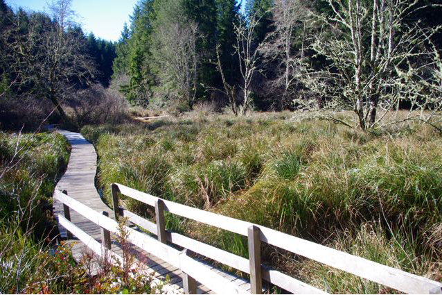
Craig Holt . . . Skunk cabbage should be in bloom.
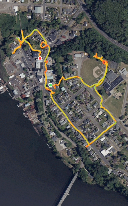
A double loop hike is offered - hike the Kwis Kwis Trail in one direction and return on the Fort to Sea Trail for a total distance of 7.3 miles and an elevation gain of 1125 feet . . . see Map
Some may prefer a shorter hike - just one loop for a total 4.2 miles (3.6 miles if you take the Connector).
Meet in the parking lot on Marine Drive between 2nd & 3rd Streets in Astoria at 9:00 a.m. or in the RV/overflow parking lot at the Fort Clatsop Visitor Center at 9:30 a.m. If you have one, please bring a National Park entry pass and let Craig know that you have one with you (1 Pass admits 4).
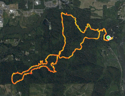
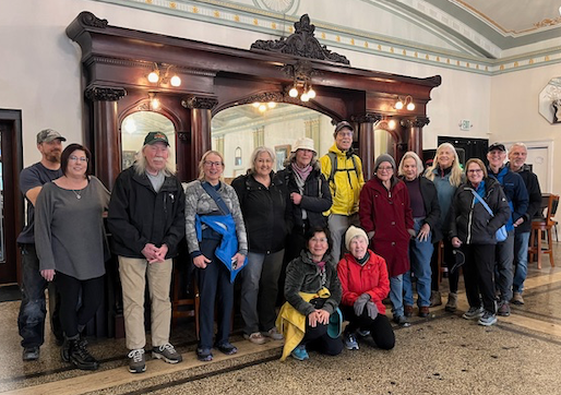
7.90 miles, 4 hours 46 minutes, 1,051 feet elevation gain
16 hikers + 2 goats . . . 2 hiked only the first loop
12 April
6:30 p.m.
Beach – sunset 7:59 pm, moon rise 8:07 pm
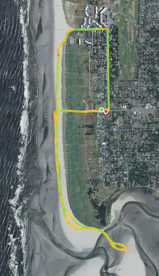
3.68 miles, 1 hours 59 minutes, 47 feet elevation gain
19 April
9:00 a.m.
led by Joe Balden
Hike will start at Ecola State Park. Note Fee per car is now $10 to park.
Directions: Take first Cannon Beach exit. Right turn at first stop sign, 1/4 mile to right turn onto Ecola Park Road.
The hike can include multiple parts:
First is the 2 mile hike over the cape to Indian Beach. Elevation gain 400'.
Second segment from Indian Beach is 1.3 miles up to Hiker's Camp viewpoint on Tillamook Head. Elevation gain 750'.
Option 1. Leave vehicle at Indian Beach for one way hike over Ecola.
Option 2. Do over and back to Ecola State Park.
Option 3. Do the hike up to the Hikers Camp, returning to Indian Beach and car.
Option 4. Do the entire out and back to Ecola.That is about 7 miles and a lot of elevation up and down.
My plan is to do one way from Ecola to Indian beach, up to Hikers camp, back to Indian Beach and car. I will meet Astoria group at Ecola State Park 9:30 AM. 1/2 hour drive from Astoria.
Note: I hope that we have fair weather for this event. If weather is pouring rain then cancellation is in order. The trails are in fair condition but low spots are going to be muddy.
I hope to hear from you if you are planning to join me on this walk through beautiful forest and ocean overlooks--whales are out there!
Please RSVP Joe Balden - joebalden70@gmail.com;
503-801-3762
8,9,10 May
9:00 a.m.
Smith Creek Village reserved for May 8 & 9, 2025
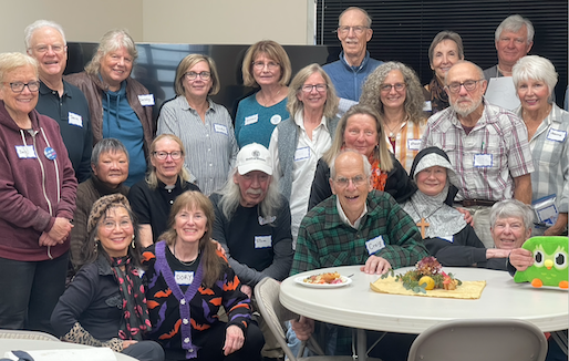
A new concessionaire was taking over Smith Creek Village when we arrived. The Angora Hiking Club had made reservations a year in advance which were honored. Except for a few employees, we had the entire village to ourselves. There was no food service available in the park, but we ate well having brought ice chests packed full of food in our vehicles - not enough wine though. Blueberry Lodge was closed for maintenance, so we were offered Dogwood Lodge instead which was nice because Cedar and Dogwood Lodges are close together making it easy to walk back and forth between the two. Cedar Lodge was the quiet house, Dogwood Lodge was the PARTY House.
Friday morning nine hikers drove up to the South Falls parking lot and headed down the Canyon Trail. Janet Fryer, Susan Korpela, Phuong Van Horn, and Dan Vernon hiked as far as Winter Falls, then up and out of the canyon taking the Rim Trail back to the parking lot. Craig Holt, Melissa Hunt, Rhonda Piasecki, Rachel Siegel, and Linda Thompson continued on under and past North Falls to the North Falls parking lot and then the Rim Trail to the South Falls parking lot.A wonderful time was has by all. It was agreed that three nights next year would be better.
14 May
1:00 p.m.
Brad Catton - 92219 Hiway 202, Astoria
Arline LaMear to facilitate the hike.
17 May
9:00 a.m.
led by Dave & Debbie Gray
. . .
24 May
9:00 a.m.
led by Arline LaMear
. . .
28 May
1:00 p.m.
led by Jeanne Hyatt
. . .
31 May
9:00 a.m.
Markham, 503-436-2310 . . . Sunrise 5:28 a.m.
6¼ miles, 3¾ hours
92 feet elevation gain
7 June
9:00 a.m.
led by Arline LaMear
. . .
14 June
9:00 a.m.
led by Dave & Debbie Gray
. . .
21 June
9:00 a.m.
led by Arline LaMear
. . .
25 June
9:00 a.m.
led by Arline LaMear
. . .
28 June
9:00 a.m.
led by Rick Gregory
. . .
1 July
8:00 a.m.
led by Deborah Howe & Eric Wheeler.
The Angora Hiking Club has been summiting Saddle Mountain for over 100 years, even before there was a trail. This is a beautiful hike with a profusion of wildflowers and breathtaking views. The trail length is about 5 miles with 1650 feet of elevation gain. The hike is rated 5C the table included in “10. Guidelines for Hikers” found here.
See this link for more information on the Saddle Mt hike.
5 July
9:00 a.m.
beyond. Meet in the Shively Park parking lot off
of Williamsport Road . . . led by Dory Lukas.
12 July
12 noon
Bring your favorite dish & your own beverage.
Paper products provided. Fee: $5/car. Map
16 July
8:00 a.m.
led by Deborah Howe & Eric Wheeler
. . .
19 July
9:00 a.m.
parade at noon. Stop at the Berry Patch on the
1.62 miles, 1 hour 20 minutes, 173 feet elevation gain
20 July
9:00 a.m.
led by Jan Fryer
. . .
26 July
9:00 a.m.
led by Arline LaMear
. . .
30 July
9:00 a.m.
led by Joe Balden
dog friendly
2 August
8:15 a.m.
north to The Breakers and walk 8.3 miles back to
We will park our cars at the Port of Ilwaco and take the 9:10 Pacific Transit Bus for $1 to the north starting point of the Discovery Trail by the Breakers condos.
The Discovery Trail is 8.3 miles along the Pacific Ocean shoreline. The walking is EASY but the distance is long. The trail is very walkable with gentle rises and dips. The trail surface is mostly paved with some boardwalk and dirt/pea gravel. There are no roots, steps, rocks, or car traffic, only bicycles. The first 6 miles going south are open dune grass mixed with evergreens and ocean sightings. The last couple of miles are thru a wooded area with tree cover.
There are portable or permanent toilets at miles 2, 2.4, 3.7, and 6.5 on the Discovery Trail.
Port of Ilwaco Bus Stop - Howerton & Pearl Avenues
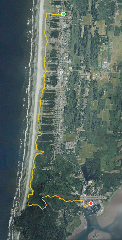
8.32 miles, 3 hours 31 minutes, 290 feet elevation gain
6 August
9:00 a.m.
led by Jan Fryer
. . .
9 August
11:00 a.m.
led by Phuong Van Horn . . . 503-791-5748
13 August
1:00 p.m.
led by Darlene Burtsfield
. . .
16 August
9:00 a.m.
led by Arline LaMear
. . .
20 August
1:00 p.m.
led by Jeanne Hyatt
dog friendly
6 September
8:00 a.m.
This year we will ride a MAX light rail train into Portland from Hillsboro to start the 4T trail hike. Get off of HWY 26 at North Plains (exit 57) and take Glencoe Road south which becomes N 1st Ave in downtown Hillsboro. Upon crossing the MAX tracks, theres’s a parking structure — enter under the yellow sign and drive up to the 3rd level for free Park-n-Ride parking. Take the elevator down, cross the street to the MAX station and buy a full day ticket. An empty train will be waiting. Get off the train at the Washington Park station in the tunnel and ride the elevator 256 feet to the surface and the hike begins.
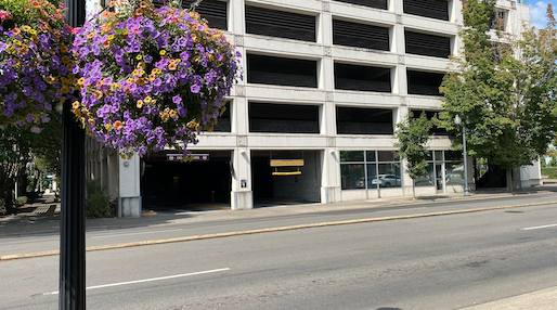
Going past the zoo entrance, we walk down a new sidewalk, over Hwy 26 and up, up, and up to Council Crest, then down Marquam and Shadyside trails to the Marquam Shelter to eat lunch, then up Connor Trail to OHSU. The OHSU Tram ride costs $8.50 round trip, so we’ll ride the Tram down and back up again, then walk down following the MAP shown here. Fare for the Tram is paid by tapping a card with a chip and then using the QR code on the ticket to open an entrance gate. Once again at the lower Tram station we'll walk across the Tilikum Crossing Bridge and board a trolley running clockwide to board a Blue MAX train going to Hillsboro a block beyond the Multnomah County Library. Then home again.
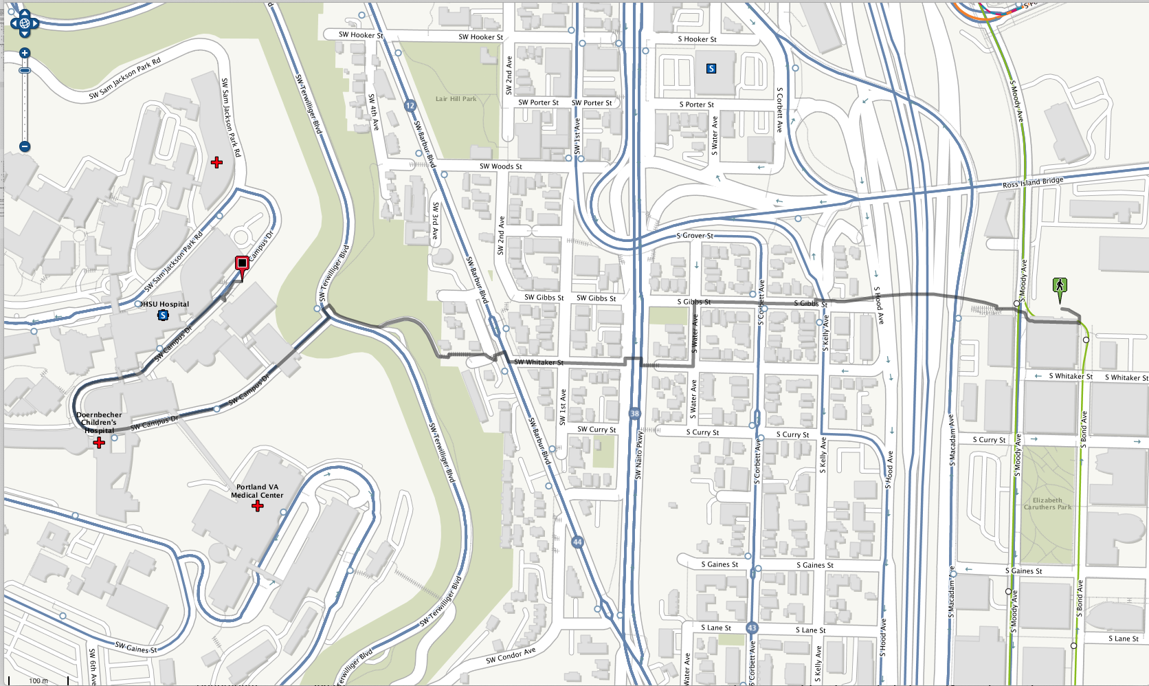
5 hours 40 minutes, 7.28 miles, elevation gain 850 feet.
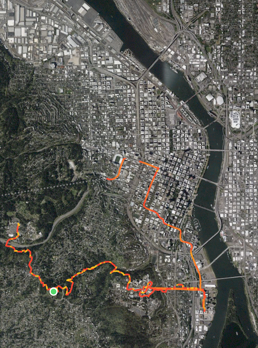
Name the nine bridges over the Willamette River.

13 September
9:00 a.m.
led by Linda Thompson
. . .
20 September
1:00 p.m.
led by Phuong Van Horn
. . .
27 September
9:00 a.m.
led by Arline LaMear
. . .
4 October
9:00 a.m.
led by Deborah Howe & Eric Wheeler
. . .
12 October
Very Early
. . .
. . .
18 October
9:00 a.m.
led By Darlene Burtsfield
dog friendly
22 November
2:00 p.m.
organized by Phuong Van Horn . . . 503-791-5748
4 January
2:00 p.m.
Conference Room 231, 2001 Marine Drive,
Astoria - led by the Chief Guide
For additions and changes to this schedule:
attend meetings,
read your e-mail, look above 🙄 and/or check the “Community
Notes” in The Astorian newspaper on Thursday.
On all hikes stay together, follow the leader & stay ahead of the
“sweep”. Notify the sweep if you’re leaving the group.
Dues are $10 per calendar year, best paid by January 31.
— Membership not required to hike with the Club. —
No dogs are allowed on Angora Hiking Club hikes/walks.
— kids and old goats are permitted —
President Craig Holt
503-325-8207 craig·holt◊me·com
Vice-President Linda Thompson
360-355-6034 lindatho2021◊gmail·com
Chief Guide Arline LaMear
503-338-6883 cliffandarline◊msn·com
Treasurer Jeanne Hyatt
503-861-0201 jandjhyatt◊msn·com
Secretary Eric Wheeler
608-797-7753 ericwheeler2◊gmail·com
Facebook Betty Pecchio
503-784-5612 bpecchio◊hotmail·com
Angora Hiking Club
Post Office Box 1212
Astoria OR 97103
I’ve belonged to quite a few clubs in my time
But one stands out, ’way above the rest –
The Angoras are the outfit that I liked best.
When hikers turned out, seeking real action,
That night they went home with full satisfaction;
Adventures and fellowship in that group were tops!
My recall of Oregon & Washington scenes never stops.
Yes, I’m so glad I was privileged to be a member –
And particularly now that my life’s “near December”.
(9-9-93)