Angora Hiking Club
Astoria, Oregon
Archives – Badge – Sign-up – Apply
100 years – Goat – Photos – Songs
History – Documents 1921, 2018, 20
Schedule 21, 22 Rules Leaders Hikers
31 December
10:00 a.m.
Wheeler [RSVP 608-797-7753]. Meet at the
Astoria Coffee House & Bistro - 243 11th Street
7 January
10:00 a.m.
RSVP 608-797-7753 . . . ericwheeler2◊gmail·com
meet at AWCC - 111 W. Marine Drive in Astoria
8 January
2:00 p.m.
Conference Room 231, 2001 Marine Drive,
Astoria - led by the Chief Guide Arline LaMear
14 January
10:00 a.m.
& Eric Wheeler – Meet: Peter Pan Market,

3.25 miles, 2 hours 23 minutes, 370 feet elevation gain
20 January
9:45 a.m.
led by Ken Dell . . . 916-588-7462
meet: 2nd & Marine – $3.50 lunch didn’t happen
28 January
9:45 a.m.
the Lewis & Clark River Bridge west of Miles
4 miles, 2 hours, 7 foot elevation gain
4 February
9:00 a.m.
608-797-7753 . . . stopped at the Berry Patch


11 February
9:15 a.m.
Steve Wright, Seaside Mayor and President of the

18 February
9:30 a.m.
25 February
9:45 a.m.
by Jim Smith. Deb Howe & Ken Dell hike leaders.
4 March
9:30 a.m.
led by Ed Joyce . . . 503-468-0995


5.21 miles, 2 hours 56 minutes, 1,374 feet elevation gain
18 March
10:00 a.m.
sunshine and a clear view. An Astoria urban walk is
better. Meet: 13th St. between Duane & Exchange.
25 March
9:45 a.m.
1 April
9:00 a.m.
hikers gathered in the parking lot when it started
to rain. They all went home to hike another day.
8 April
2:00 p.m.
1111 Exchange – Bring your favorite dish & your
own beverage. We’ll provide the paper products.
15 April
8:45 a.m.
22 April
8:00 a.m.
led by John Markham . . . 503-436-2310
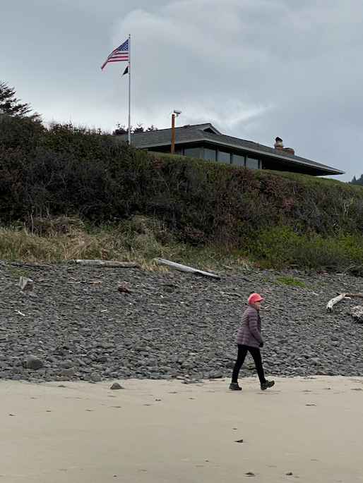
6¼ miles round trip, 2½ hours
29 April
9:00 a.m.
Washington led by Janet Fryer . . . 503-697-1753

Benson Beach hike – 5.62 miles, 2½ hours
3 May
1:00 p.m.
in Ilwaco
led by Rebecca Lexa
6 May
9:00 a.m.
Cathlamet hike led by Craig Holt
Lunch at The Berry Patch in Westport, Oregon
13 May
9:00 a.m.
led by Dave Fitch . . 503-325-8089
20 May
9:00 a.m.
hike led by Heather Simpson . . . 503-298-3418

4.92 miles, 3 hours 34 minutes, 840 feet elevation gain
26,27,28 May
9:00 a.m.
organized by Arline LaMear . . . 503-338-6883
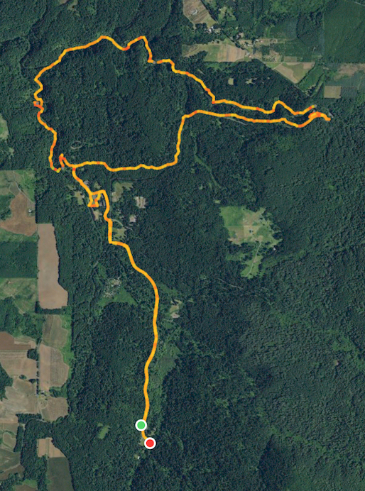
12.0 miles, 6 hours 8 minutes, 935 feet elevation gain
We walked north from Smith Creek Village to South Falls,
then hiked the Canyon Trail to North Falls and returned
via the Rim Trail. Note the GPS signal lost under the
North Falls basalt overhang.
31 May
8:00 a.m.
in the Columbia River Gorge
led by Susan Bowe . . . 503-440-6466
3 June
7:00 a.m.
led by Meg Linza . . . 503-502-8782
7 June
12:00 p.m.
led by Joe Balden . . . 503-801-3762
& Penny Eberle . . . 503-801-7990
10 June
9:00 a.m.
led by Craig Holt and Dory Lukas
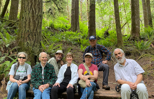

5.04 miles, 3 hours 10 minutes, 806 feet elevation gain
17 June
9:00 a.m.
led by Dory Lukas . . . 907-302-1054

24 June
8:00 a.m.
from the Port of Ilwaco north to The Breakers and
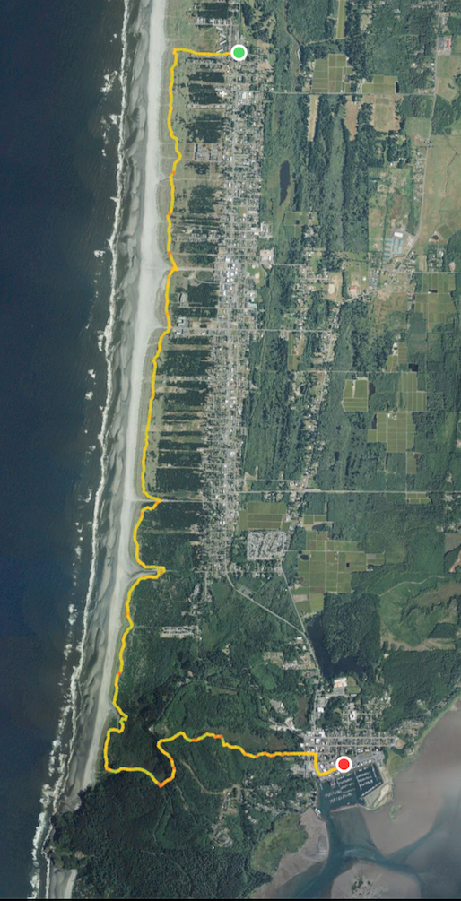
8.32 miles, 3 hours 31 minutes, 290 feet elevation gain
24 June
9:00 a.m.
North Head & Coastal Forest Loop trails
led by Deborah Howe & Eric Wheeler
1 July
8:00 p.m.
walking south to the Necanicum River and back.
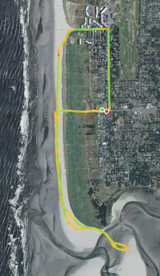
3.68 miles, 1 hours 59 minutes, 47 feet elevation gain
5 July
8:00 a.m.
led by Heather Simpson . . . 503-298-3418
8 July
9:00 a.m.
8.30 miles, 6 hours 14 minutes, 1990 feet

15 July
9:00 a.m.
led by Jan Fryer . . . 503-697-1753
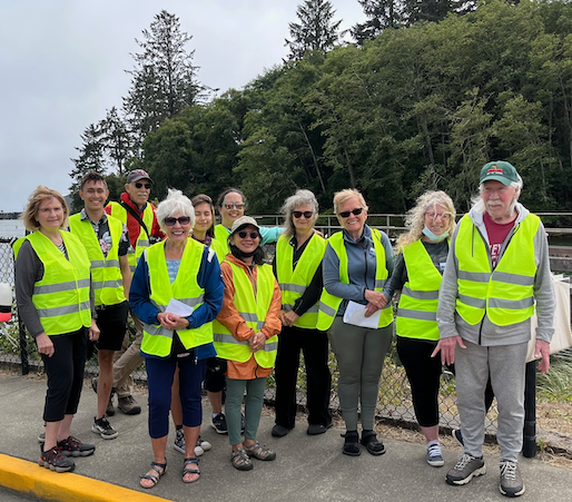
20 July
1:30 p.m.
led by Heather Simpson . . . 503-298-3418
Event Closed – all six spots have been filled.
22 July
12 noon
Bring your favorite dish & your own
beverage. We’ll provide the paper products.
26 July
1:00 p.m.
led by Carol Merwin, Deborah Howe and Jo Brown

This Angora city-walking-tour features wall murals and ghost signs – remnants of vintage hand-painted advertisements on old buildings. The tour leaders are Carol Merwin, Deborah Howe and Jo Brown. Jo painted many of the murals we will be seeing. She will be able to speak to painting logistics, choosing what stories to tell and the challenges of preservation. We will have an opportunity to see murals that had been lost and are now being restored. We will consider vintage signage that is not being restored properly. And we will discuss how we can cultivate institutional and community support for murals and historic signs.
The tour includes two locations that are not normally accessible to the public.
This three-hour tour will cover 3.75 miles on city streets and the Riverwalk. We have a lot to cover so the walking will be fast paced between stops.
We are limiting the group size to 20 registrants, so it is necessary to RSVP in advance. Carol Merwin will handle registrations; please send a text to her at 503-961-2401. Questions can be directed to either Carol or Deborah Howe (503-432-1255).
If interest exceeds available space, we will consider hosting a second tour.
We will meet on the east side of the former Builders Supply, now the Columbia Maritime Museum, on 18th and Marine.
You can park along 18th and in front of this building.
5 August
8:00 a.m.
north to The Breakers and walk 8.3 miles back to
waiting cars – led by Dory Lukas . . 907-302-1054
12 August
11:00 a.m.
led by Phuong Van Horn . . . 503-791-5748

2 September
9:00 a.m.
led by Joe Balden . . . 503-801-3762
& Penny Eberle . . . 503-801-7990
6 September
1:00 p.m.
led by Debby Halliburton . . . 360-977-0982
& Cathy Cruikshank . . . 360-434-1232
9 September
9:00 a.m.
crossing the Neahkahnie Headwaters Preserve hike
In 2020, a new 2.1 mile stretch of the Oregon Coast Trail (OCT) was opened between Nehalem Road in Manzanita and the South Neahkahnie Mountain Trailhead. The new section, much of it developed by Trailkeepers of Oregon, crosses the Neahkahnie Headwaters Preserve, a property managed by the Lower Nehalem Community Trust. The new trail is popular with locals, but it’s also an attraction for visitors, allowing for a longer and less crowded approach to the Neahkahnie Mountain Viewpoint.
Check both ways carefully before you cross Highway 101 to the beginning of the new OCT section. The graveled trail is lined with a split-rail fence and passes a clearcut planted in 2019. For the first mile or so, it follows a phone line corridor, a grassy track that undulates and passes into the verging woodland of Sitka spruce and hemlock for short stretches. Highway 101 is never far away to your left.
Passing out of the corridor, the route enters a woodland with an understory of salmonberry, sword fern, and salal. You’ll see a house to your left before you enter a clearcut and switchback up twice. Large slash piles decorate the landscape, and foxgloves bloom profusely here in the summer. There are views up to the forested slopes of Neahkahnie Mountain. Some large spruce trees have been left standing in the clearcut. Switchback up three times to cross an old logging track and enter secondary forest.
Two more switchbacks take you to a view south of Nehalem Bay and the coastal hills above the Nehalem and Kilchis rivers. A sign tells you that you’re leaving the Neahkahnie Headwaters Preserve as you descend an alder-shaded slope with a rushing creek below. Dense thickets of salmonberry cloak the slope above the trail. The trail then switchbacks over a ridge and passes under arching elderberries. There are a handful of impressively large cascara trees in this area. Soon, you’ll emerge at a kiosk and Road 38555. Bear left to hike down the road about 100 yards, passing a gate. You’ll reach the South Neahkahnie Mountain Trailhead, from which you can make the 1.3 mile ascent to the Neahkahnie Mountain Viewpoint.
The Lower Nehalem Community Trust secured property along the east side of the highway, the City of Manzanita helped secure funding, private landowners allowed access across their land, and the Trailkeepers of Oregon and Northwest Youth Corps were brought in to build a new 1.8-mile section of trail connecting Oswald West State Park land with US 101. As part of the agreement, TKO agreed to maintain the trail for 25 years.
Special mention also goes to Connie Soper, who helped coordinate and inspire much of the effort and also wrote a terrific book about the Oregon Coast Trail.
LIMITED PARKING – park on shoulder of Nehalem Road.
16 September
9:00 a.m.
We begin the hike at Council Crest Park (elevation 1,071 feet) in Portland because the parking is free and easy. Entering "Council Crest Park" in Google Maps will have you exit Hwy 26 at MP 71 - Sylvan Exit, then guide you the rest of the way.
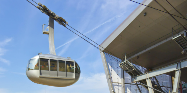
We hiked down Marquam and Shadyside trails to the Marquam Shelter where we ate lunch, then up Connor Trail to OHSU. The OHSU Tram ride costs $8 round trip, so we rode the Tram down and back up again, then walked down to the trolley following the MAP shown here. Fare for the Tram is paid by tapping a card with a chip and then using the QR code on the ticket to open an entrance gate. Trolley fare is paid once on-board by tapping a chipped card again – this time no paper ticket is issued – a database somewhere records that you paid $2 for 2½ hours and remembers you when you tap before getting on a Red or Blue MAX train going to Hillsboro. We got off the light rail train at the Washington Park Station in the middle of the tunnel and rode an elevator 256 feet up to the surface in front of the Portland Zoo. We then completed our circular trip back to the Council Crest Summit. On the drive back to Astoria, a wrong turn was taken, so we ended up in downtown Portland and took I-5 north to Longview and Hwy 30 to Astoria. To retrace your way back to Astoria, consult this MAP to drive by the Hilltop Chevron Station.
5 hours 40 minutes, 7.28 miles, elevation gain 850 feet.
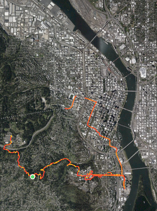
Name the nine bridges over the Willamette River.
23 September
8:00 a.m.
7 October
9:30 a.m.
led by Phuong Van Horn . . . 503-791-5748
14 October
8:30 a.m.
led by Deborah Howe . . . 503-432-1255
Join us on a visit to Raymond, Washington where we will tour the Northwest Carriage Museum followed by a walking tour that highlights historic buildings such as the theater and library and a marvelous collection of steel sculptures.
The Carriage Museum is a world class institution and our tour guide, Jerry Bowman, will keep you riveted with his deep knowledge of the history of carriages along with his expertise in restoration. The tour will last two hours followed by lunch along the Willapa River. We will then embark on a 2.5-mile walking tour of Raymond which will give us an up-close look at the 1993 Heritage Sculpture Project which produced over 200 sculptures designed by local artists reflecting native flora and fauna along with the community’s history. Click here for pictures of some of these sculptures.
We will meet at 8:30 am at the parking lot at Marine Drive and 2nd Street in Astoria. Those in Washington can meet us at the Museum at 10:00 am. Museum tickets cost $9.00. Bring a bag lunch to eat along the river.
Please RSVP by text to either Deborah Howe (503-432-1255) or Vicky Meek (360-942-8151). There is no limit to the group size, but the museum would like to have a head count before we arrive.
28 October
2:00 p.m.
organized by Phuong Van Horn . . . 503-791-5748
(costumes optional)
18 November
9:00 a.m.
Eric Wheeler and Barry Brown. Meet in front of a
Join Eric and master stone mason Barry Brown for a look at the craftsmanship of selected stone retaining walls in the Shively-McClure historic district.
This urban walk has some steep elevation and covers approximately one mile in about two hours.
Meet at 9 a.m. in front of 1135 Grand Ave, a large American foursquare just east of the First Presbyterian Church.
Please RSVP Eric Wheeler - ericwheeler2@gmail.com;
608-797-7753
25 November
9:00 a.m.
led by Eric Wheeler – meet at 15th and Exchange
Where and what is Fort Hill? Join us and find out as we explore some of the best historic buildings in the central historic district. This is an urban walk of less than two miles with some steep climbs and descents.
Meet at the Fort Astoria historic site on the northwest corner of Exchange and 15th Streets at 9 a.m.
Please RSVP Eric Wheeler - ericwheeler2@gmail.com;
608-797-7753

2 hours 18 minutes, 1.11 miles, elevation gain 212 feet.
2 December
9:00 a.m.
at the Uppertown Firefighters Museum located at
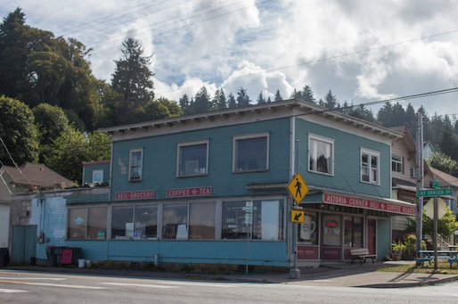
We’ll ramble through the historic neighborhood with a stop at the Astoria Coffee Company at 37th St. and Leif Erickson Dr. There is a possibility that a ‘coffee angel’ will descend upon those who make it to the coffee shop. We’ll return to the Uppertown Firefighters Museum along the riverfront to round out the 1.5 mile route in about 2 hours.
Please RSVP Eric Wheeler - ericwheeler2@gmail.com;
608-797-7753


2 hours 49 minutes, 1.59 miles, elevation gain 82 feet.
9 December
2:00 p.m.
1111 Exchange – Bring your favorite dish & your
own beverage. We’ll provide the paper products.
16 December
9:30 a.m.
led by Ed Joyce . . . RSVP: 503-468-0995


5.24 miles, 2 hours 51 minutes, 1,338 feet elevation gain
7 January
2:00 p.m.
Conference Room 231, 2001 Marine Drive,
Astoria - led by the Chief Guide
For additions and changes to this schedule:
attend meetings,
read your e-mail, look above 🙄 and/or check the “Community
Notes” in The Astorian newspaper on Thursday.
On all hikes stay together, follow the leader & stay ahead of the
“sweep”. Notify the sweep if you’re leaving the group.
Dues are $10 per calendar year, best paid by February 15.
— Membership not required to hike with the Club. —
No dogs are allowed on Angora Hiking Club hikes/walks.
— kids and old goats are permitted —
President Craig Holt
503-325-8207 craig·holt◊me·com
Vice-President Dory Lukas
907-302-1054 dorenelukas◊gmail·com
Chief Guide Arline LaMear
503-338-6883 cliffandarline◊msn·com
Treasurer Jeanne Hyatt
503-861-0201 jandjhyatt◊msn·com
Secretary Eric Wheeler
608-797-7753 ericwheeler2◊gmail·com
Facebook Betty Pecchio
503-784-5612 bpecchio◊hotmail·com
Angora Hiking Club
Post Office Box 1212
Astoria OR 97103
